Saturday, 26 April 2014

Pedal On Parliament

Pop 2014 - Young rider on a balance bike
I was in Edinburgh today to take part in the 2014 edition of Pedal On Parliament, a rapidly growing protest march (?) from the Meadows to the Parliament Building at the foot of the Royal Mile.

As always seems to be the case with me, just getting to the start line was a chaotic rush. My bike has not been working properly since I got back from holiday, with the chain jumping gears seemingly at random, thus making it virtually unusable. As such I've (regrettably) been driving to work for the last week - in other words, re-acquainting myself with all the reasons why we need a proper cycling strategy in Scotland (*sigh*).

Given that I'm rather incompetent when it comes to mechanical things (I can understand them but my hands just don't work properly when there's a screwdriver or a hammer in them!), Saturday was the first proper day I'd have the opportunity to get to the bike-shop to get it looked at. I thought I could just about limp over to the shop, drop it off, then head into town for the train to Edinburgh. About halfway there, my chain decided to snap (second time this has happened recently) meaning I had to do that most inconvenient of things - walk the bike along the pavement.

It was therefore with more than a sense of consternation that I discovered the shop was closed - I really hope it was just because the owner was at PoP! Hence I had to turn tail and head back to the house to drop off the now useless device and then change clothes (despite wearing gloves, I'd somehow managed to get oil on my trousers - curse you, impractical touring bike)! After a bit of fretting and charging about the house, I managed to get safely out and onto the Edinburgh train for 10:45 - Phew!

Hurrying along North Bridge, I just about managed to make it to the start of the route just as the bells and whistles rang out at 12 - PoP was officially starting!
Pop 2014 - at the start of the route
The front of the "peloton"
The pictures don't really do it justice, but the line of people on bikes stretched right the way along the path over to the road at the other side of the Meadows. It was really heartening to see the diversity of the crowd - men, women, children, elderly people; folk on foot, on MTBs, tandems, fixies, recumbents, cargo bikes - a few people even had mobile sound systems! In particular, I was taken by the fact that there was a good mix, sartorially speaking. Not everyone was in hi-viz, lycra and helmets - plenty of folk in "normal" dress, as well as a large contingent of dapper trendy-types (usually on vintage Pashleys!).  If this isn't illustrative of the suppressed demand for cycling, I don't know what is.
Scotland: not really a "cycling country" is it?
Abandoned clothing doesn't disrupt the PoPers!

I suspect the bike counter was struggling to keep up!

Perhaps I missed the memo, but  the pedestrians I saw appeared to be passers by and onlookers - most people taking part were on bikes, which made me feel slightly left out (I really wish the bloody thing was working). In what might be regarded as a foolhardy move, I chose to march on the path with the people on bikes - I wanted people to know that I was part of the event - which meant that I was frequently in the midst of a horde of bikes but there was a friendly atmosphere, with people on bikes looking out for me and each other without incident.
Looking west down The Royal Mile
As I marched down the Cannongait, the main peloton took advantage of the incline and raced ahead, leaving me to walk down the middle of the closed-off street on my own, which made me feel a little silly and self-conscious. Eventually I reached the main contingent at the green outside the Parliament, where I met Sally Hinchcliffe - one of the organisers of PoP and a leading member of The Cycling Embassy of Great Britain. She was somewhat pre-occupied with directing people to talk to their MSPs but it was nice to put a face to a name finally - a common phenomenon of the internet age I suppose...

"The Grassy Knoll", as MC Dave Brennan drolly put it
(I also noticed some of the Cycle Hack contingent hanging about, which reminded me that I've yet to get my ticket - I was a bit shy to go and speak to them unfortunately...)

After a bit of delay while the remaining stragglers arrived, the speeches began. In something of a coup for the event, the first set of speakers were all children, who (aside from some understandable volume issues) bravely spoke really well and articulated the primary issues better than most of the adults who followed. The only exception being the dignified speech made by Lynne McNicoll - co-founder and trustee of The Andrew Cyclist Charitable Trust - who brought home why making Scotland's roads a safer place is so vital.

Keith Brown MSP, not being heckled

The keynote speaker though was notionally Keith Brown, MSP, who was actually more politely received than I expected (having anticipated the sort of reception usually reserved for education ministers at teaching union conferences). In terms of the content of his speech, well he was a little defensive when talking about his department's record, as well as the paltry £4.5M (over 2 years) he conveniently managed to cobble together in time to announce on the eve of PoP. The significance of that announcement seemed to be more about it being sourced across multiple departments including Health and Sport, rather than being wholly from the Transport budget - apparently there is no precedent for this in the Scottish Parliament - than the actual size or use for the funding. Given that PoP are asking for £100M per year, the sums involved in this announcement are clearly inadequate and tokenistic.

The most important element of his speech was the fact that he was delivering it at all. The fact that he was brave enough to attend suggests that PoP is starting to be taken seriously by some at Holyrood - a fact underlined by the presence of Willie Rennie, leader of the Lib Dems in Scotland, who appeared to understand the issues facing people on bikes. He talked anecdotally about commuting from Fife to Edinburgh.

Probably the most disappointing element about the political presence was the distinct lack of a west coast contingent - it was very much Edinburgh-centric when it was supposed to be about Scotland as a whole. As far as I could tell, for the whole of political cohort Glasgow, only Patrick Harvey MSP bothered to attend (apparently Councillor Frank McAveety was there too but I never saw him). In this Commonwealth year, shame on Glasgow's political class for failing to show up. Edinburgh is only a 50 minute train ride away - it's hardly the ends of the Earth!

The biggest cheers of the day (for political speakers) were for Alison Johnstone, Green Party MSP for Lothian who clearly (and predictably) "gets it", with regards to the obvious benefits of building a true cycling culture. Unfortunately the Greens are still very much a marginal (albeit noisy) presence in the Parliament - which underlines why it's even more vital to get the mainstream parties on board.

Dave B with daughter* - that's what it's all about isn't it?
Thereafter, the event came to an end, with people still milling about and chatting amongst themselves. Feeling a bit spare, I departed for a pint in the art deco-themed City Cafe and then headed off for the train. A feel-good worthy day out but one which underlines the continued need for sustained pressure - PoP undoubtedly helps to frame the conversation, but there's a long way to go if the aims of the manifesto are to be achieved. Assuming it happens, I'll be going again - hopefully this time I'll be able to persuade some friends to come along!


(*) I don't make a habit of taking pictures of people's kids in public incidentally, but it seemed an appropriate image for PoP!

Sunday, 20 April 2014

Cycling in California


For this post, I'm going to describe my impression of cycling in California, specifically San Francisco  - somewhat of a diversion from the usual subject of this blog. For the last few weeks, I have been holidaying in the Golden State. Part of our itinerary involved three nights in San Francisco, notable for having one of the highest cycling modal shares in the USA - I couldn't resist the opportunity to try it out.

Before I start the discussion, a few caveats:
  • Probably a bit controversial for a cycling advocate to admit but my holiday was - first and foremost - a driving holiday; therefore a proportion of the observations were made from the seat of car
  • With that said, as when on holiday, we walked a lot and made use of public transport in SF
  • We mainly drove during off-peak hours - we tended to avoid the busiest periods - thus might not have had a realistic perception of traffic and congestion
  • Cycling provision and modal share across towns, cities, counties and states can differ enormously
  • I was there primarily as a tourist and was thus concentrated on enjoying myself - I wasn't there specifically for a study tour
  • My impressions and perceptions are my own - it's very likely that I've made errors of fact or incorrect assumptions
  • For the more egregious errors I make, I welcome comments from residents or people better informed - please, please let me know!

California

Venice Beach, CA
Firstly, I'll take a look at my impression of cycling in the state as a whole, bearing in mind I only actually got on a bike in SF.

Intinerary


Here's a rough itinerary of the whole trip:


View Larger Map

As you can see, we covered quite a lot of Pacific, Central and Southern California, as well as a couple of (fairly weird) days in Las Vegas, Nevada. We spent the greatest amount of time in the big cities of Los Angeles, San Francisco, Las Vegas and Palm Springs - almost all of the other places were daytime visits or overnight stop-overs.

General

I think it bears stating the obvious first of all: like other parts of the US I have previously visited, California is overwhelmingly set up to accommodate motor vehicles. Cars are - almost without exception - given the highest priority. Aside from congestion and traffic (a big aside, I know), it is generally convenient and comfortable to drive about; there is simply so much space allocated to you. From the sprawl of Los Angeles and the so-called "Inland Empire", to little provincial towns like Pahrump NV, most roads are at least five lanes and often widen to seven  - pretty much all of them feature a central lane dedicated to making left turns (equivalent of our right turns). Most towns are arranged in traditional grid-iron layouts, meaning you tend to travel along a die-straight road between seemingly endless arrays of crossroads. Local, minor highway infrastructure that would count as a major trunk-road in the UK are ubiquitous.

A typical street in LA
Urban zoning thus caters for this car-centric mindset with most businesses being sited in strip malls, large "big box" retail parks or on their own standalone lots with parking round the back - thus somewhat paradoxically, on-street parking is almost non-existent except perhaps in the busier high-density down-town areas. This means that there's often a lot of space by the kerbside that rarely exists in the UK (this will become relevant in due course).

Traffic Law

Traffic laws also prioritise traffic, with "jay-walking" (i.e. pedestrians crossing the road away from designated areas) being an offence and with some peculiarities relating to red lights. Unless otherwise stated, you can make a right-turn on a red light if there is no obstruction - you are merely obliged to stop, then "yield" (give way) to vehicles coming from your right or to pedestrians on the crossing to your left. One strange (but paradoxically welcome) consequence of this  arrangement is that waiting times for pedestrians are much shorter, because the pedestrian crossing phase cycles much more frequently (as they don't have to wait until all four arms of the junction are at red). Other than traffic lights, stop signs are the primary means of controlling traffic at junctions: four-way intersections with stop signs at each are a common arrangement; European-style give-ways are relatively rare.

Clearly there are potential problems here because it relies on drivers being aware of pedestrians and their willingness to stop, which could create conflict. Perhaps because US drivers are continually stopping and yielding, combined with the ambiguities of the red light and the four-way stop - it comes naturally to look out (is this not one of the principles of shared space after all)?

Speeds are on the whole higher than in the UK. Most roads have a 35 mph speed limit or higher (25 in school or in some residential zones). Aside from parks or civic squares, I only recall one instance of a pedestrianized zone (indeed, the only other examples I can remember seeing in previous trips to the US are Times Square in New York and Main Street, Memphis TN).

Cycling

As is hardly surprising, motor traffic is legion. What is thus perhaps more surprising is that cycling is common here too. Against my expectations, even "the city where nobody walks" - Los Angeles - has a large contingent of bike users. I believe this is facilitated in part by the acres of space on the carriageway, the lack of on-street parking and the peculiar traffic laws (thus legitimising red light jumping). Painted cycle lanes are a common sight on many streets, although they share similar problems with their UK counterparts, namely that they tended to abandon the rider at junctions and provide no explicit priority (although I guess one might use the pedestrian phase to traverse it). Some painted cycle lanes have an additional painted buffer with solid hatched lines which provide a little extra distance and the subjective sense of separation (despite no physical barrier). I do not recall seeing any protected cycle paths, although off-road sections through parks existed. Suffice to say, I saw very little in the way of filtered permeability, which seems like a lost opportunity, given that the grid-iron layout of these cities means there are often multiple routes to the same destination (and thus scope for diverting motor traffic away from some routes).

Signage and painted symbols explicitly warn drivers to be aware of bikes and to "share the road" - on roads with narrower lanes, you'll often see things called "Sharrows" which indicate to drivers than people on bikes will be in the middle and have  priority (this perhaps indicates the vehicularist mindset that underlies US cycle policy). Anecdotally, I have heard that some states have laws which require cycles to yield to traffic behind it if they are "causing an obstruction", which appears to be if more than 5 cars are queuing behind them - whether or not this applies in California, I'm not sure, but the presence of sharrows suggest it might be the case.

A (slim) majority of bike users I observed wore helmets but it certainly wasn't universal. Perhaps as a function of the climate (hot, sunny, dry) and the geography, very few urban riders were kitted out like how we typically view "the cyclist" here - the vast majority wore normal (weather appropriate) clothes and shoes - almost none of it "hi-viz". There were a lot of people riding fixed-gear bikes, either the typical "hipster"-style fixie or (my favourite) large, heavy-looking cruiser bikes.

Like this but usually brightly coloured
I never got the opportunity to ride one of these beasts but they were available to hire at resorts like Pismo Beach, Palm Springs and in Monterey (I curse myself for not checking to see if you could hire them in SF!). One of the more pleasing sights towards the end of the trip was at the Coachella Music Festival, where it seemed that hundreds of festival-goers cycled to and from the venue on precisely this sort of ride, evidenced by the lines of them locked to fences at the entrance (contrast to Scotland's big festival T in the Park, where almost nobody cycles).

Much like this... (not my picture incidentally!)

San Francisco

Bike Hire

One of the things I'd wanted to do months before I came to the city was to cycle over the Golden Gate Bridge - I knew this was possible by virtue of people who had done it previously suggesting it. You can cycle over the bridge to a little town called Sausalito in Marin County and get the ferry back to the city. 


I consulted our guidebook and came across a few options for hiring bikes - none of the suggestions were terribly close to the down-town area we were staying in. There was one past North Beach, which (in hindsight) was actually relatively close to the bridge but we also wanted to have a go at cycling around Golden Gate Park, a lovely rectangular park with similarities to New York's Central Park, although in my view slightly misleadingly named, as in reality its not particularly near to its namesake bridge.


One oddity about San Francisco, which has a large public transportation system - MUNI for buses, BART for its metro system, as well as the world-famous hill-climbing street-cars - doesn't seem to serve the western part of the city particularly well, with only the buses going west of Van Ness Avenue. Hence, after a somewhat disconcerting walk through the rather sketchy Tenderloin area we had to hop what seemed like the slowest possible trolley bus through the Civic Center to the Haight-Ashbury district (you know, "Haight-Ashbury"...? Flower power, Grateful Dead, Jefferson Airplane etc. Ask someone less square!), replete with slightly scary passengers talking to themselves...

Hiring a bike

We arrived at the hire centre, which was at the eastern gates of the park. Aside from the vehicle, it was a similar experience to hiring a car, namely filling out a form, adding on the extra charges for insurance and the damage excess waiver (!) and then providing a credit card (with the ubiquitous ID request). Somewhat disappointingly, the only bikes available were generic (albeit well-maintained) mountain bikes - no cruiser bikes for me unfortunately. It took between 5-10 minutes to get set up and ready to go.

I should add that, at this point, I saw the park on the little map they provided, as well as what looked like a continuation of that park up the coast and round towards the bridge... perceptions can be deceiving, as we were to discover.

Golden Gate Park

We set off through the park, which has some surprising features, namely that a whole lot of traffic drives through it, specifically Highway 101 ("El Camino Real") - as the name suggests, a very busy road which makes its way directly across the park and on towards the bridge. I took one look at it and thought "well, we're not going that way!". Thankfully, there are relatively traffic free routes around the park, although to my surprise (given what I know from Glasgow parks) there were multiple restrictions on where you could use the bike. Mainly these were bike lanes on the road, albeit with a large painted buffer between you and traffic. We travelled along John F. Kennedy Drive down a gentle slope towards the western coast and the Pacific Ocean.

After a quickly dipping our feet in the water, we headed northwards to what turned out to be a fairly steep cliff to what I presumed was the rest of a trail towards The Presidio and henceforth to the bridge itself. My cycle partner - not a seasoned commuter cyclist like me - started to complain about the additional unexpected effort. It's difficult from a map to appreciate the geography of the city, in particular the numerous steep hills that dominate it. I hadn't anticipated this particular set of climbs I must admit. After a bit of huffing and puffing, we turned into Land's End Park and followed what was marked as a cycle trail, which I expected to take us to "El Camino Del Mar". We cycled on until we reached a large, steep set of stairs... followed by yet another steep set of stairs!

At this point, my cycle partner doubted my navigational skills, so rather than face the 2nd flight of stairs, we turned back and headed towards Point Lobos Avenue, which seemed to take us back towards the city (and another large hill to climb). We turned up towards Clement Street, where I took this picture:

Looking South - this is quite a steep hill
But at this point, my companion was at near breaking point, not particularly liking the exertion, the hill or indeed cycling on the roads with traffic. So we took a turn-off at the Legion of Honor and diverted back down Camino Del Mar to... the set of stairs we'd turned back from earlier (if I'd held my nerve...). So I didn't in the end get to cycle over the bridge, although we did get to travel over it a couple of days later ... by car:

Not as much fun though...

As for the rest of the hire, we dotted back through the park again, although this time we travelled along the much less forgiving Martin Luther King Jr. Boulevard, which again entailed cycling completely with traffic - in the end, we bailed from the roads and (illegally) carried on the footpath - such was the unfriendliness of the traffic and the parked cars (again, in the middle of park - why?).

Dropping off the bike was fairly easy, albeit by the time we returned they were getting pretty busy with other customers. It's a pity that a more local hire service couldn't be found to make it a bit easier to explore the city - albeit the hills make that a daunting prospect. This is precisely the sort of place where I'd expect a bike-share scheme to come into its own, which brings us nicely into the next section...

Bike Share

I'd been hunting about for SF's bike-share scheme since we arrived and I finally came across it during my aborted attempt to visit the Museum of Modern Art at the edge of the SoMa district - remember kids: check the website before you travel, otherwise you might find your destination is closed for refurbishment (!) until 2016. Having a few hours to kill, I headed along Market Street, a long wide avenue that cuts diagonally south-west across the down-town area from the bay at the Embarcadero to the famous Castro District and beyond. It's notable for being really pretty much flat (certainly compared to other nearby streets!) and for being a major thoroughfare for public transport -  MUNI, BART and streetcars all have hub stations here. There are numerous shops, department stores and even a Westfield centre.

Getting the bike

I happened upon the 4th Street bike station as I was wandering up Market and decided to investigate. Similar to London's bike-share scheme (which I'd not had the courage to try out last time I was there) you have a line of bikes deposited in docking stations, alongside a little kiosk/auto-teller device. For unregistered, casual users like me a credit or debit card is required to make use of it. The hire process is similar to the way you might buy a rail ticket at an automated teller - except with a few more options. After what seemed like several minutes of clicking through screens (most of which appeared to be liability disclaimers), I had paid my $9 for 24 hour usage (free for 30 minutes per hire, thereafter a sliding scale of charges for every additional half hour) - contrast this with the flat rate of $2 for a one-way ticket on the MUNI which we took to Golden Gate Park the previous day.

A little ticket printed out, providing me with a 5 digit (base-3) code to take to the bike and enter to unlock. At this point I made an error - for some reason, I typed my code into an empty docking bay (I think I momentarily got confused about where you had to enter this code - total idiot!), which was duly accepted and proceeded to unlock my non-existent bike! In a panic I tried re-entering the code into an occupied dock but it wouldn't accept it! I returned to the kiosk, concerned that I'd be counted as having "rented" an invisible bike and would be charged the full "lost bike" amount. Happily when I re-swiped my card, I was immediately issued with a new code, which successfully released a bike. Phew! Perhaps they don't think anyone would be daft enough to try an empty dock but it would have been better if it had recognised the lack of a bike and had rejected my code in the first place. In any case, I checked out my newly acquired steed (you ought to do this first, it occurred to me later), verifying the brakes functioned and that the seat was adjusted correctly, thereafter I set off along the street towards the Embarcadero. I should add was wearing sandals, shorts and T-shirt at the time - no special clothing required!

The bike itself is a little heavier than my own but it is very comfortable (albeit not ideally proportioned for my 6'3" frame), with swept back handle bars and a wide, chunky (well cushioned) seat. It has seven relatively low-ratio hub gears (given the hills, this is probably for the best), a set of permanently-on lights and a little basket area, replete with stretching rope-tie. One odd thing for me was that the gear changer rotated counter to the way I'm used to - hence I sometimes found myself in the top gear at the junction or would find my legs comically whirring at pace whilst in full motion as I shifted lower in error.

I felt a little rush of joy as I swept along the cycle lanes of Market Street at a relatively gentle pace. I found myself un-harried by the cars in the lane to my left, nor indeed was I bothered much by the trolley buses and street-cars that otherwise patrol the route. Perhaps because I am relatively comfortable mixing with traffic, combined with the wide Californian streets which afford a bit of confidence. It's easy to be seduced by the relatively care-free nature of this sort of cycling; the weather, the sight of other (normal) people on bikes. For a moment, I genuinely had a feeling of the sort of ordinary, stress-free cycling that people in the Netherlands take for granted. However, this changed a little as I reached the Ferry Building.

The Embarcadero


View Larger Map
 I found out later that this road had once been the site of a large two-level expressway which was damaged during the 1989 earthquake and subsequently demolished - if only Glasgow's council had the courage of San Francisco's mayor Agnos, who pressed ahead with the removal of this once polluting eyesore on the shore of the Bay, in the face of vociferous opposition from local business interests (sounding familiar?)

The resulting space has opened up the bay-front area - which as the name "Embarcadero" suggests consists of a series of landing piers for ferries and cruise ships - and is now a major tourist area (trap?), regularly overflowing with pedestrians, generally pottering about buying chintzy souvenirs or catching the ferry over to Alcatraz. There is however still a two-carriage roadway going north-south, which is where the problem is. There are painted cycle lanes on the roadway and thats the route I took northwards to Pier 39.

Looking at the map as I have been writing this blog, I notice that there's seemingly a parallel cycle path on the pavement but I assure you that this wasn't particularly clear - what you appear to have is a shared pavement; a textbook example of why these arrangements don't work properly if there's too many people on foot. Suffice to say, I remained in the cycle lane.

This is where it starts to unravel. Despite removing the express-way, this is still an exceptionally busy road, filled with slow moving motor traffic (although thankfully it is no longer directly linked to the nearby Bay Bridge). I was heading northwards and it should be noted that there are no further right turns here - all the junctions ahead (other than bays for taxis and buses) came from the left. And yet cycles are still expected to stop at all red lights, which I duly did. And the lights took what felt like aeons to change - I was passed several times by less patient cycles who (naturally) passed safely through the junction against the red light.

Suddenly, without warning the cycle lane just gave up and I was back in amongst the cars - this is the point where my Glasgow cyclist instincts kicked in and I reverted back to a quick, aggressive vehicular style of riding. I was also starting to panic somewhat as I couldn't find a docking station and was keenly aware that my 30 minutes time limit was rapidly running out. This is where my initial fears about bike share schemes were realised - how do you find a station?

Station-hunting

Now it will be argued that bike share is merely intended as a form of public transport: you start off at point A and you get off at point B, just like you would a train or a bus. It isn't necessarily meant for someone to just drift about aimlessly on. In hindsight, what you clearly need to do is examine the map and identify the station you want to stop at, but this still requires a degree of navigational competence and awareness. If you get on a bus or a train, the stops are generally called out and (unless you are particularly unlucky) the driver will know where he or she is going - it's just a case of counting off the stops and waiting for the appropriate point to jump off. Bike share schemes don't have the benefit of this - you are on your own.

It turns out that there's a Bay Area Bike Share App which can help you with this (although I'm not sure if it features navigation functionality to guide you there step-by-step) but again this wasn't clear when I set out to use the service (I don't recall seeing it being advertised at the docking station). What would have been more useful would be the inclusion of bike share stations on Map applications, in the same way that metro and bus stops are usually - then you could make use of the sat-nav feature (bearing in mind this would use up some precious and ludicrously expensive international roaming data).

I can't remember which junction I turned off the road onto, but I tired of being held in queuing traffic on the Embarcadero, so I opted to change to a parallel road (Front Street), which to my astonishment turned out to be almost empty of traffic. "Why aren't the cars here?" I thought to myself.

Eventually, after fruitlessly circling about looking for the blasted docking station, I elected to turn around and come back the way I came, heading back onto the busy bay-front road. This time, the road layout was more complicated, due to the numerous right-turns. Here, the bike path will often divert left over into the second lane to allow right-turning traffic to cross the cycle lane and hug the kerb - in other words, a design for conflict not a million miles away from what I found on the Clyde Gateway.


View Larger Map

Mission Street

I bombed as quickly as I could down the road and turned right onto Mission Street - as this was down-town, I did encounter on-street parking which required me to adopt a traditional primary position. Note, the "sharrow" on the road in this next street-view image:


View Larger Map

On Mission, the bike lanes are replaced in favour of the more familiar (to me) bus and bike lanes, which meant sharing with taxis. At this point, I'm firmly out of holiday-pottering mode and fully into a defensive cycling mindset - although how refreshing to do it without all the accoutrements of British cycling (namely helmet, hi-viz jacket etc. - I'd recommend trying out cycling in sandals incidentally). However, I'm starting to sweat profusely (not just due to the warm April afternoon), which isn't my idea of calm, normally clothed utility cycling. My aim was now clear - find a station back where I came from in time to meet my partner at 5pm. After more fruitless journeying down Mission, I looked to my right and noticed this pedestrian pathway - the pedestrianized zone I referred to above:


View Larger Map

... but there was no indication whether or not I could use this on a bike! Thus I had to carry on a further two blocks to 5th Street, in order to turn back on myself along Market to the 4th Street docking station - the only location I knew for certain I could return the bike to! So there I was - a bit of a sweaty, dishevelled mess returning to where I had left, probably about 30 minutes over my time - but arrived safely.

Thoughts

As I hope I indicated in the text above, I found the overall experience of using the bike-share to be pretty good. Clearly there were problems finding a docking station but that could perhaps be mitigated with a bit of forward planning. The big problem is still the obvious one - infrastructure. I still can't really fathom why cars are permitted on the Embarcadero - there seems to be no real reason for traffic to be there (other than that required for access to the piers perhaps) - it certainly wasn't a convenient way to travel. It seemed to me that it could be directed away via other parallel routes, or perhaps motor traffic could be restricted to one side of the street-car tracks (the western carriageway), with the remaining lanes being given over to pedestrians and bikes. It would also be nice to permit northbound bikes to bypass the junctions completely - there's no need for the continual stopping and starting next to noisy, dirty traffic.

One thing I didn't touch on above - like a lot of bay area public transport, the bike-share scheme is overwhelmingly concentrated in the eastern down-town areas, specifically around Market Street, in what appears to be a mirror of the BART metro station layout. I'm guessing this is intended to allow BART users to transition quickly onto bikes for the so-called "last mile" journey - perhaps with destinations such as SoMa or North Beach in mind. The westmost station is at the intersection of Market and Van Ness Avenue (a major trunk route northwards to the Golden Gate Bridge, Marin County and beyond), at the threshold of the Lower Haight. As I pointed out in the bike-hire section, the only ways to get west of this point is to walk, drive or take a bus, which seems somewhat disenfranchising to residents in this part of the city, never mind in places like Mission.

I also thought the cost was a little steep for what you get, and it wasn't clear to me how people who don't have bank accounts (let alone credit or debit cards) would have access to the scheme. You don't need a credit card to use a bus or the metro, why for a bike? Given the poverty I witnessed in areas such as Tenderloin, I'd be interested to know if people of more modest means could apply for free access or discounted rates. Otherwise it begs the question: who is the bike-share schemes for?

Was it a good way for a tourist to see a city? Well, the true bike hire scheme allowed a little more freedom (in that you were provided with a lock) but I liked the relative simplicity of bike-share - the fact that the bikes are (in a sense) disposable from the user's point of view. The bike was sturdier and more comfortable than the generic mountain bike we were allotted previously. It's definitely a more fun way of getting to know the city at ground level than, say, getting on a sight-seeing tourbus (and no need to tip anyone on the way either). But the slight stress of not knowing the destination, unfamiliarity with the roads might be a barrier, particularly if the streets lack the required sense of subjective safety.

Whether or not I'd use such a scheme at home (such a scheme is due to be implemented next month) I'm not sure - one of the new stations will be near my house, but this will only be temporary - like the residents of Richmond, SF, the Southside of Glasgow is going to be pretty much neglected by it. I would certainly recommend trying out such a scheme if you happen upon one in your travels though! Just remember to check the map first...

Saturday, 22 March 2014

Clyde Gateway: Part One

Believe it or not, the green smudge is a cycle path

Foreword

Take a look at the image on the left - that treatment was done about ten years ago. On the left of the picture is a fire-path - a static piece of infrastructure that blocks normal motor traffic whilst allowing access to Fire & Rescue appliances. On the right is a cycle path connecting Dixon Road to the Toucan crossing on Aitkenhead Road. As you can probably infer, one of these features has survived a lot better than the other. There are multiple examples down the road of similar treatments, each rotting away at a similar rate.

I went to a local resident's association meeting last summer, where representatives from the council's Land & Environmental Services came out to talk with us about what they were doing to improve the roads in the area. I spoke to the spokesperson for the team that does the painting. Ludicrously enough, painting the road appears to be the responsibility of a separate department from the teams that resurface the roads - if you ever wondered why roads sometimes get re-painted one week then tarmacked over the following week, this is probably why. I asked him about sections of cycle path like the one above; I wanted to know why this wasn't being maintained. He advised me that the original piece of work came from a special, one-off fund. There was no budget for re-painting the cycle paths around this part of the city. Therefore, short of a miracle, or an extra injection of "special" funding, the above path will continue to deteriorate until there's nothing but the dropped kerb and the sign. The fire-path - made out of actual bricks and mortar - will remain though for much longer.

The bottom line is: paint alone doesn't work. This fact will become more pertinent as I look at the state of the new infrastructure work that's been carried out in and around the main Commonwealth Games site in Dalmarnock and Parkhead - a project that's been labelled "The Clyde Gateway". It featured in a rather scathing article in the Guardian about the mooted "Commonwealth Legacy"; a piece which has inspired me to write this blogpost. As its quite a large area, I'm going to break down the analysis into a few posts.

Overview

In November 2007, Glasgow was announced as the Host for 2014 Commonwealth Games. That has set in motion a series of major building and infrastructural projects to create an "East End Cluster" of sporting venues, an athlete's village and transport routes to facilitate access. This included a major refurbishment to Dalmarnock Railway Station, and the construction of a new road (or at least a major re-routing and refurbishment of existing roads) called the "East End Regeneration Route", the naming of which suggests a beneficial purpose. This coincides with the completion of the highly controversial M74 extension between Tradeston and Tollcross, which has lead to the creation of a new junction - J1A Polmadie - linking up to the new road. Thus when I refer to the "Clyde Gateway", I'm referring to the route between the new motorway junction, the Velodrome and the Forge Retail Park at Parkhead.


View Larger Map

Historically speaking, this route is - in a sense - a partial completion of the inner city ring road, proposed in the notorious Bruce Report (the apogee of Glasgow's post-war modernist planning mindset). I referred to this previously in discussion of High Street, which would have formed the eastern flank. This revised edition pushes the flank further eastwards, but ultimately forms a (nearly) continuous route between the M74 and the M8/M80 at Provan, albeit in the form of an urban road, rather than a motorway. With that said, some sections of the route are 4 or even 6 lanes wide - if it looks like a duck... etc

Presumably as part of the approvals process for getting the bid and to justify building new roads, provision for cycling has been factored into the design. The new cycle infrastructure has been pridefully referred to by Glasgow City Council officials as prime examples of how to implement "quality" facilities. without wanting to jump the gun, I think it will come as no surprise to suggest that they are somewhat deluded in that regard.

Anyway, let us begin.

Polmadie

Here's an oblique satellite view of M74 J1A:


View Larger Map

As you can see, it's a bit of a mess - with multiple stacking lanes, signal-controlled junctions and potential for conflict between local users and people exiting and entering the motorway. It isn't nice for motor vehicles, people on bikes or those brave few pedestrians who venture this way occasionally. For the cars, there are three sets of lights to pass through if heading northbound. Cycles and pedestrians have to brave numerous crossings on shared use paths, all while surrounded by heavy traffic - this is not somewhere one wants to spend a lot of time.

I'll start off at the southern side of the junction. If you've read my last post, you'll have seen this image below already, as it forms part of the cycle route between Cathkin Braes, Hampden Park and the Velodrome. As you can see, it's a shared use pavement, with a two-stage toucan crossing - so far, so inconvenient.

Toucan Crossing, replete with the much-derided tactile paving

 Things get worse on the northside of the junction, where we encounter not just another two-stage toucan, but (gasp) a building!
Nnngh! More crossings to wait at
 The planners seem to have been taken by surprise by the existence of this static object. Remember that this is still shared use, but rather than widen the footpath and take some of the lane away from the roadway, they've simply given up and stuck a "Cyclists Dismount" sign before the problematic blind corner - abject capitulation:

If I were responsible for this, I don't think I'd be advertising it, Transport Scotland
 Thereafter, we join the Clyde Gateway proper (or New Rutherglen Road, as it is more correctly called). Here you see a prime example of the divisive and counter-productive Dual Network philosophy in action - on the left, an inconvenient shared use pavement for "novice" cycle users, and a dodgy, hated ASL on the right for "experienced" users.
At least it isn't painted green
At this point, the shared use path on the left pretty much stops dead - if you want to carry on further, you have to cross over the junction at the toucan, then wait at another two-stage crossing to get to the rest of the path. The alternative is to roll into the ASL (note the dropped kerb) and mix with the cars and lorries.

Oh, did I mention that this path just... kind of ... stops mid-way?

Yes, this is supposedly segregated shared use - where does the bike go, on the grass verge?
After this point the signs just give up, with no path back onto the road, nor any indication where the shared use ends and illegal, anti-social pavement cycling starts. Again, I sincerely dislike shared use, but at least commit to it properly*.

The aggravating elements about the junction are three-fold:
  1. It's new - they've virtually had a blank slate to work from and this is what they came up with
  2. It's big - there's quite a lot of space to work with here. Aside from the railyard to the south-east, there's ample space to build around
  3. It's unavoidable - between the motorway and the railway line, there are few crossing points for north-south traffic; unless you want to divert two miles or so west or east, this is the route you must take
Thus, inevitably the choice is made between convenience (i.e. getting through the junction in reasonable time), versus safety (staying on the pavement away from motor traffic) - even with that, there is a problem with consistency. 

Shawfield

Here's the next major junction - a (relatively) complex 3-way convergence:


View Larger Map

Unless further plans have been submitted which I have yet to see, there is no provision here for cycling - you either have to dismount and walk the bike along the pavement, or brave the road. Despite re-routing, there doesn't appear to have been any attempt to integrate cycling here explicitly, although the wide, two lane bend allows motor vehicles to take the corner onto Shaw-field Drive at speed (assuming a green light).

Moving further on, we reach another signal-controlled junction, and then the Rutherglen Bridge over the Clyde.


On the left of the picture and just beyond the lights is the entrance to Richmond Park, which forms part of National Cycle Network route 756 (East Kilbride to Kelvinside). This will become relevant in due course.


At the bridge, we see yet again how designers seem to consistently capitulate when it comes to the more complex parts of the route - once again, there is no provision for cycling over the bridge whatsoever - not even a shared use path. Once we cross the bridge, things start to get interesting (but not in a good way). It's here that we see the beginnings of what presumably gets the council officials excited:

Ta-daaaaa!
You have what amounts to a slightly-fancy dropped kerb and more shared use paths, this time with explicit segregation applied by - you guessed it - painted lines. As I outlined in the foreword, painted lines have a limited lifespan when compared to actual physical infrastructure. It's quite clear that this work has been implemented with the Games in mind, thus without further funding to maintain it, eventually this path will just revert to pavement again.

Things take a turn for the worse though when we reach the next junction:
The path runs out and we're suddenly directed ...
  
... straight into an ASL!
As is no doubt blatantly clear, there are several problems with this approach. If the person on the bike cycles along the path then rejoins the road the junction at a green light whilst left-turning traffic is driving alongside, there's an almost guaranteed left-hook opportunity. Bike and car will be travelling parallel to each other - making observations unituitive. Note where the grey car is turning left in the 2nd picture - this is where the person on a bike will be if they are heading straight on. There is no give-way when the path rejoins the road, thus who has priority here isn't made explicit. It relies on the car spotting the person on a bike coming off the pavement and then giving way appropriately - a recipe for conflict which we'll see repeated several times on this route.

For safety, the design relies on the ASL, but ASLs only (just about) work if you approach them during the red light phase. Now, no doubt Glasgow City Council officials will advise you that the previous junction's signals are timed to ensure that people on bikes never reach this junction at green... that is if you don't come from Route 756, which bypasses those lights entirely. You simply cannot guarantee that bikes will always reach the junction on red.

Our hypothetical GCC official might point out the blue sign in the first picture indicating the possible presence of bikes. But it isn't clear that this actually means "cycle path rejoining the carriageway". Given how often drivers are observed infringing on the ASL, is it likely that they will notice this unusual traffic sign? It is more likely that the driver will expect the person on the bike to give way to them.

The route to the left takes you back towards the city centre via Glasgow Green - traffic use this route to travel to the eastern half of the city centre, avoiding the main Clyde crossings - thus there is almost always someone turning here. It's probably just luck (and a lack of cycle traffic going straight on) that a collision hasn't occurred here.

--

This is probably a good place to stop for the time being - the next post will look at the sections between here, Dalmarnock Station and the Velodrome.

What the...?

I've been doing some photography for my upcoming blog series about the Clyde Gateway. As I was out and about I've noticed that they're in the process of implementing the plans for extending* the cycle route between the Velodrome, Hampden Park and the Cathkin Braes Cycle centre. As has been noted previously, the majority of this "new" infrastructure takes the form of slightly increasing the width of the pavement on some sections and putting up Shared Use signs. What I don't understand though, is what this is for:

Not the streetlamp! The border
On some of the shared routes (not all, I should stress), they've added this oddity - an area of beige hardcore-like material bordered by a solid white line. I can't work out what the purpose of it is. Is it to discourage people on bikes from crossing over and dropping off the pavement? Perhaps it's there to to substitute the "need" for fencing - but if so, there are still sections of fencing on the same routes, particularly around the junctions:
Shared Use path leading to M74 J1A
A little further on the same route - note the fencing

On the plans, it is referred to as:
Buff coloured screed 500mm thick with solid white line 500mm set back from kerb edge
Can anyone suggest a valid reason for it, momentarily side-lining the issue of it being Shared Use and therefore useless?


Monday, 17 March 2014

Cycle Parking: Supermarkets - Lidl & Aldi

Last time, I looked at the cycle parking provision at Morrison's Gallowgate and Asda Toryglen. This time, it's German discount chains Aldi and Lidl that get the treatment.

Overview

Compared to long established chains like Tesco and Sainsburys, Aldi and Lidl are relatively recent editions to Glasgow's supermarket retail scene, despite being fixtures of continental European high streets for decades. Although subtly different in service and products, they both share similar traits. They are both a product of German supermarket philosophy, which favours smaller shops in urban settings - as opposed to the UK's love of US-style out-of-town big box hypermarkets - with a focus on providing a (relatively narrow) range of good quality, own-brand products with steady (budget-orientated) pricing; you don't find the profligacy of multi-buy deals common with the so-called "big four" retailers. Efficiency is key, with items being displayed in floor to ceiling packing crates (hence they are in a sense, self-stacking and self-clearing), tills which only open up when required and where customers pack their shopping at tables away from the tills (thus improving the flow rate).

As is probably quite obvious from the above text  I unequivocally declare myself a fan of both brands (although I have no relationship with them) - I like the smaller scale, the low prices and that I can find pretty much all I need shopping-wise; there's also the coup of including the "mystery middle aisle" (more on that later). As they are so evenly matched, choosing one or the other depends a lot on small details - a specific product, where I am at a given moment, the direction I'm travelling in etc. One of the factors that can have an influence if I'm shopping on my bike are the facilities for me to park.

There are four Aldi stores in Glasgow proper, with several in the periphery of Greater Glasgow, including Rutherglen, Clydebank, Paisley, Erskine, Bellshill, Motherwell, Airdrie and Hamilton. Lidl has a similar spread, although is more firmly established - there are about double the number of stores in roughly the same radius, with at least 12 within the city boundary. I'll look at the closest examples of each. Aldi Rutherglen, approximately 1.7 miles away and Lidl Victoria Road, a mere 0.8 miles distance. It goes without saying that both are easily commutable by bike distance-wise; the road conditions differ significantly though.


Aldi Rutherglen

Note that I'm cheating again by including Rutherglen, which isn't technically Glasgow. Indeed, it's actually part of the South Lanarkshire Council area. However in reality, the town integrates pretty seamlessly with Glasgow, forming a de-facto local business district for this part of the South-side. Aldi is (in my opinion) the slightly "posher" of the two, with better products (for example, the hommous is just that bit tastier :) ). It is also on my commute, hence I'll often pop in for some dinner after work.  The shop sits just slightly away from Rutherglen Cross, near the (slightly intimidating) pedestrian subway under Glasgow Road and Rutherglen Main Street. As befits a small urban supermarket, there's a modest car-park, with the majority of customers coming on foot.

As indicated above, Aldi has a the mystery middle aisle, in which can be found a series of seasonal or limited offer stock - a veritable Aladdin's cave of bric-a-brac and pot-luck ephemera, from kitchenware and tools to clothing and electronics. Aldi is notable amongst cycling enthusiasts for its "Crane" range of cycling apparel, which (like much of Aldi's product range) is of decent quality - I have a number of items which I use on a daily basis that have originated here.

Regrettably and counter-intuitively, Aldi Rutherglen lets itself down with bike provision - there is no "official" parking at all.


Trollies and ... erm ... plants are well served


"But there are Sheffield Stands there", you might say. Yes, there are metal barriers, but these are intended to wrangle trolleys. When full, there is no room - not to mention the danger of the bike being damaged by errant shoppers in a rush to get a trolley. This despite a recent refurbishment of the car-park to add additional spaces (FOR CARS) at the back of the shop. 

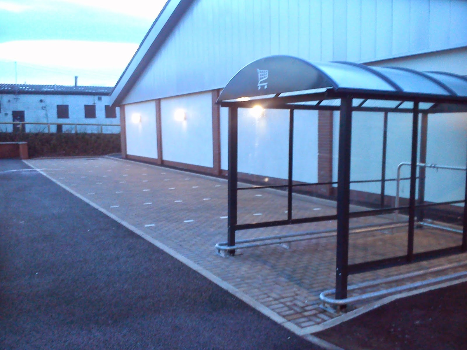
Brand New Parking and Trolley shelter


Other than the railings for trolleys, there are fences near the car-park entrance - exposed and relatively far away from the shops front door. The implication is very clear here - dry trolleys and cars are more important than bikes. It's such a shame that the management (either local or regional) fail to understand this, particularly given that they provide reams of specific "Parent & Child" parking too:


Couldn't just one of these spaces be allocated for bikes?
There was a clear opportunity to improve facilities here with the renovation work which has been squandered. This would suggest that someone believes that the way to get more customers into the shop is to provide extra parking, which I believe is a false paradigm. The size of the shop precludes the sort of bi-monthly bulk buying that fits with car dependency. Supermarkets like this and in this area are suited better to more frequent/smaller quantity shops - the kind more suited to pedestrian or customers arriving by bike.

Lidl Victoria Road

Yay Lidl!
By contrast to Aldi Rutherglen, the bike provision here is streets ahead. Unfortunately the photograph was taken at a time when some work was being done on the roof, hence the cherry-picker parked beside it - but imagine this same scene without it or the (slightly) encroaching Heras fence. There are 8 good quality Sheffield stands - room enough for 16 bikes, which compares well to the limited number of parking spaces for cars. The stands are sheltered from the elements by a purpose-built roof, in other words they aren't sheltered by accident of design - someone has actually gone and designed this facility specifically with bikes in mind. 


The two bikes at the back are posh stainless steel custom affairs


The shelter is also prominently and conspicuously placed in the small car-park close to the entrance - the trolleys get top billing again (of course!). But its clear that Lidl recognise that their setting - an urban high street on a bus route - is going to get the bulk of its trade from pedestrians and people on bikes, and they've prepared for them. Bravo to Lidl Victoria Road! If only they started selling bike apparel, the choice would be a lot easier.

Post-script

Thought I would note this little enjoinder. Across from Lidl, there's a small example of where filtered permeability techniques can be misapplied if not designed properly. The road here has been blocked off to through motor traffic with large, flat bollards, but there's supposed to be a little cycle by-pass. I say it like that because in reality, it isn't really usable, because of the close proximity of the bus-stop - people (naturally) use the bollards for sitting and tend to congregate on the pavement.


As you can see, the painted bike lane has long since worn away - the dropped kerb and the faded blue bike sign being the only real evidence of its previous existence - this is a pattern we see quite a lot throughout the south-side. A more useful approach would have been to direct the path away from the vicinity of the bus-stop - 5 metres or so to the right perhaps - and to mark out the path physically with either a drop in height, or a different surface type.