Over a year ago,
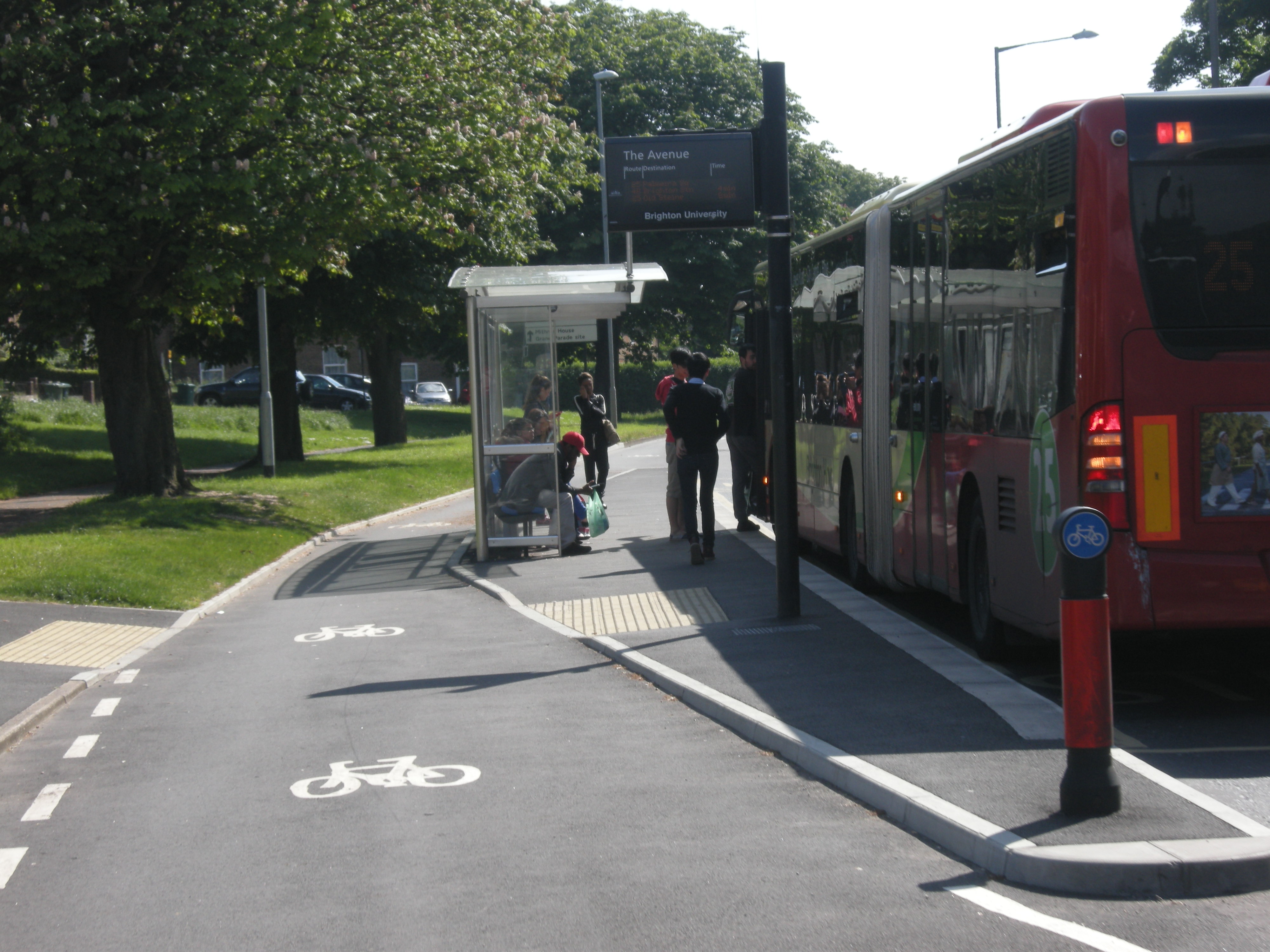
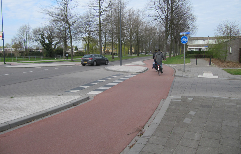
I wrote a response to the consultation on East Dunbartonshire Council's new "Bears Way" scheme in Milngavie, which involved some on-street improvement works but - most importantly - a new segregated cycle path; the first of its kind in the area. My initial assessment of the plans amounted to cautious approval, albeit with some reservations; aspects of the plans like the bus-stop by-passes were decidedly sub-optimal and incorporating a switch of sides mid-track seemed inconvenient. I made some recommendations, referencing better examples in Brighton. Thus it was pleasing to see that the plans were subsequently changed to accomodate.
The works are now nearing completion and are coming under some scrutiny. David Brennan a.k.a. Magnaton has already written commentary on his blog and has
filmed himself riding on it. Hence I thought I'd take a trip up to Milngavie to take a look at it myself.
A little note on conventions I will use:
- I rode along the route four times:
- South->North at normal pace
- North->South walking (and taking pictures)
- South->North at normal pace
- North->South at normal pace
- The entire route takes three or four minutes to traverse, not counting stops to cross the road (twice)
- As indicated above, I took pictures going north->south, which is how the picture below should flow
- The letter within brackets indicates roughly the direction the picture is looking (N) = North, (S) = South etc.
Start of Route
 |
| (S) - Start of the route. This is shared Space, including a section of pavement approximately 1.5m wide (by the car) |
 |
| (N) - Start of the Route. Also shared space to the junction, where old on-road painted path begins again |
 |
| (E) - The roundabout featuring Waitrose & Homebase. Note the absolutely vital residents parking has been retained (how else would "Wasps Destroyed" advertise?) |
The roundabout marks out the start of the new cycle facility. Access to the northern segregated section is via the roundabout itself - people on bikes coming from the A81 southbound can take the third exit onto the raised table but whether or not this is actually desirable will be discussed further below.
 |
| (S) - Shared space path at roundabout features a raised table over the junction of this minor access road. The start of the segregated section can be seen in the mid-ground |
Northern Segregated Section
 |
| (S) - Start of the northern segregated path. The line of the original pavement has been retained |
The new northern section of segregated path is approximately 100 metres in length and sits by the northbound carriageway. This means that southbound cycles need to cross the road (or access via the 3rd exit on the roundabout) to access the facility.
It ought to be said that the other side of the road features an Arnold Clark garage, but there are double-yellow lines on the adjacent pavement - it is unclear to me why this could not have featured a southbound-only section on the carriageway.
 |
| (S) A wide, sweeping curves indicates the entrance to the carpark of a gym. Quite how often access is required isn't made clear |
 |
| (S) The Northern segregated path ends here and we reintegrate into shared space, in anticipation of reaching the toucan in the mid-ground |
 |
| (S) As indicated by the painted symbol, the cycle path continues on the otherside of the carriageway. The junction on the left is the entrance to a McDonalds Drive-Thru - readers will be pleased to note that the southbound right turning lane for it has been retained |
At this point, it would be good to establish whether or not cycles can cross at toucans on red, as pedestrians are wont to do. If people on bikes can cross at will (traffic-permitting) this might be feasible to use, albeit clearly a loss of priority versus using the road.
 |
| (E) The toucan crossing - it took approximately 30 seconds for the signals to change after pressing the button. It would appear that no attempt has been made to prioritise crossings here to aid cycle users and pedestrians |
Southern Segregated Section
After the toucan crossing and another short section of shared space, we are taken onto the Southern, more substantial segregated section. From here we have approximately 1.1 km of separated path (with junctions) and four bus-stops
 |
| (S) The southern segregated section starts here |
 |
| (S) The gate on the right is for derelict land which will be developed into housing. It isn't clear if this will be the entrance to the building site or indeed to the estate itself; the presence of tactile paving suggests it might be one or both |
Bus-stop (1)
 |
| (S) The first of the "Bus-stop By-passes", lead-in chicane |
 |
| (S) - The "By-pass"(sic) |
In the original draft plan, it looked like a more primitive design was going to be employed, whereby passengers would be alighting to and from buses directly into the cycle path. This was subsequently changed to provide passengers with an island to alight onto first, which is a marked improvement.
Unfortunately, the bus-stop itself appears to be the original one and hasn't been
re-located. As such, it means that the cyclepath actually goes between
the shelter and the island; a "Pass-thru" if you like. It would be much prefererable and safer to have the shelter on the island itself, and there appears to be enough room for this to have happened. I can only assume that the costs of relocating the shelter were deemed prohibitive.
 |
| (S) The lead-out chicane from the first by-pass - note the amount of space given over and that the original kerb line has been deliberately retained |
 |
| Another Toucan crossing - note the cycle path is controlled by the same lights as for the road |
Allander Centre Junction
 |
| (S) The junction leading to The Allander Centre is in the mid-ground on the left - The segregated section returns to a shared-space section |
|
This is probably the "best" section of the route, in terms of how to safely meet a junction, although the regression to shared space is unfortunate. You can see in the next few pictures how the path is inset from the road, meaning that motor vehicles using the junction meet cycle users and pedestrians at right angles. There is also fairly clear priority for the shared path over the road, indicated by give-way lines, with plenty of space for incoming vehicles to enter and exit the junction in two seperate movements.
It would be nice to think that this design was deliberate, but the inset junction pre-dates the new cycle path. I suspect that if this were conventional junction with the pavement at the road's edge, it would not be redirected in this manner.
 |
| (S) This was clearly originally intended to be segregated shared space but has been changed into un-segregated section at the last minute (you can see the fresh paint has recently been burned off) - presumably because there would be no effective room for pedestrians |
 |
| (S) Crossing the junction - a raised table, clear give-way priority for the path, marred sightly by the colouration of the tactile paving |
 |
| (S) end of sharing and back to the segregated path |
 |
| (S) note the gutter full of leaves (in June) - This will probably be large puddle in Autumn and Winter |
Bus-stop (2)
After the Allander Centre junction, there's a slight upwards incline heading towards the second bus-stop on the route. Presumably because of this, there's no chicane in the northern approach to the bus-stop, which suggests that the chicanes on other parts of the route are purely to slow riders down, rather than being a function of pulling away from the road.
As before, the bus-stop itself is situated on the island. This time, there isn't a conflict primarily because there isn't (and presumably never was) a shelter.
 |
| (S) The 2nd bus-stop situated on an island |
 |
| (S) Passing cyce users on approach to the bus-stop |
 |
| (N) - a chicane on the southern approach, presumably aimed at slowing northbound users. Note: the bollard and accompanying island did not feature in the original or revised consultation plans |
 |
| (S) end of the southern lead-in to the bus-stop by-pass |
As you can see in the mid-ground of the above picture, there's a junction on the left up ahead. Unlike the previous junction, there's been no attempt made to re-route the path inwards; it also isn't raised onto a table like before. The kerbing of the cycle lane also stops significantly short of the junction, allowing for sweeping turns across the junction, potentially at speed.
This means south-bound motor vehicles turning left into the junction are parallel to the path. The cycle path would appear to have priority over the road here but it seems likely that motorists might not be aware of cycle users alongside and there is the potential for conflict.
With that said, this is the entrance to a driving range i.e. access-only. It would be interesting to know what the rate of traffic using this junction is. Presumably if low enough, the potential hazard of using it might be sufficiently low for this not to represent a big threat, but it is nonetheless concerning that the designers don't appear to have attempted to mitigate conflict through better design.
 |
| (S) - a sweeping curve leading into a junction - the entrance to a driving range |
We see a similar, albeit smaller scale example a few dozen metres further south, this time the entrance to half a dozen cottages. Again, the paint on the road suggests the cycle path has priority albeit without any give way lines on the side road. Again, I suspect traffic using this road for access is likely to be very low
 |
| (S) Side road on the left - note the on-street parking on the northbound carriageway and the hatching. There's the potential for another northbound lane here behind the parked cars |
Bus-stop (3)
We've reached the third bus-stop which has had a similar treatment to the first, whereby the cycle path runs between the shelter and the stop itself.
 |
| (S) Another build-out to a chicane on the norther lead-in |
 |
| (S) as before, the bus-shelter is not situated on the island |
But there's an anomaly here. Previously I suggested that the reason why the shelter was not moved to the island might be prohibitive costs. But in this case, the shelter has definitely been relocated:
 |
| (S) - the patch of tarmac is freshly laid |
Which invites the following question: Why not move it to the island? There is sufficient space and clearly it wasn't a problem to move the shelter itself. It would also have the advantage of keeping the pedestrian path wider and clearer than before - completely separating the action of alighting from and waiting for a bus, from the movement behind it. A wasted opportunity for the first
true by-pass.
 |
| (N) Another northbound chicane, bollard and island combination that wasn't on the original plans |
Bus-stop (4)
Towards the end of the route, the path runs alongside this golf shop and then to the last of the bus-stop treatments. You can see in the picture below that the kerb stops well before the entrance to the shop, as well as an adjacent access lane to housing next door, making this a bumper opening in the path.
 |
| (N) Paint hadn't been laid here at the point when this picture was taken but presumably mirrors the junction treatment at the driving range further north |
The last of our bus-stop by-passes constitutes a regression to the most primitve type of treatment, reminiscient of designs encountered on Camdem's Royal College Street. As you can see in the image below, there is but the barest sliver of pavement for passengers to alight to and from buses, thus there is the potential for direct conflict here between people on bikes and bus passengers (particularly elderly people or parents with buggies).
In an attempt at mitigation, the cycle path raises up to pavement level - I would guess that once the paint has been laid properly, either "slow down" or even give-way markings will be presented here
 |
| (S) The "by-pass" in all it's non-by-passing glory |
End of Route
About five metres on from the bus-stop, we reach the end of the cycle path, just as it reaches the mouth of a junction. In the picture below, you can see a car about to pull into the pavement to park up, in a spot where you would expect southbound cycle users to be:
 |
| (S) the car in the image was pulling in to park on the left |
Magnatom has written about this part of the route already in none too endearing terms. Certainly, like other junctions further up, the kerbing stops well before the junction, meaning that southbound vehicles could come into conflict with southbound cycle users. In mitigation, the junction merely provides access to a small cul-de-sac and traffic usage is likely to be quite light; thus conflict is likely to be fairly minimal.
To my mind, the issue is what happens afterwards. The section where southbound cycle users are reintroduced to the flow of traffic is approximately 100 metres short of Hillfoot Station, where there are several junctions, a narrowing of the carriageway at the bridge and amenities, including the entrance to a filling station as well as the first serious section of on-street parking thus encountered. This is where segregation would be at its most valuable.
 |
| (W) - the informal crossing point at the end of the route - northbound cycle users are expected to dismount here and cross the road to use the cycle path |
Conclusion
If you've read some of the previous blogs about this route, you will see that there was quite a bit of enthusiasm surrounding it. Given that it was replacing some fairly horrendous painted cycle paths with East Dunbartonshire's first fully-segregated facilities, the early promise of the consultation and the feeling that feedback was being received and acted upon by the designers gave us hope that something pretty special was going to be delivered.
Being a dual-direction path wasnever going to be perfect, switching sides was highlighted early on in the process as a potential single point of failure and the original plans to fade out at the end of the route before a junction certainly raised eyebrows, but there were some good elements to the design, like the advent of true bus-stop by-passes that made it potentially the most useable path in the West of Scotland.
As it stands, it would appear that some last minute changes - perhaps influenced by nervousness on the back of a safety audit or some negative feedback from stakeholders - has snatched defeat from the jaws of victory.
As predicted, the northern (eastern) section of the cycle path is effectively unusuable in both directions, or at least not worth attempting to use. For southbound users, the extra hassle of traversing the roundabout to get access to the path, only to switch sides a few dozen metres later isn't worth the effort, versus just staying on the main carriageway.
Northbound users can only effectively use it if continuing on Main Street to by-pass the roundabout, but are then hamstrung by the narrow shared use path. It seems bizarre to me that consideration was not made for removing the (unused) resident's parking on the roundabout as the path could clearly (and usefully) been extended northwards here.
Then there's the change of sides, which it still isn't clear where the justification for this is, given the relatively small amount of residents parking on the northbound carriageway. I can only assume that this was done to prevent conflict with MacDonalds, and the need for multiple treatments to the greater number of side-roads. Keeping the path on the northbound carriageway would have at least provided a continuous path the entire length of the route; particularly given that northbound users have to switch sides
twice if they want to make full use of it.
At the other end of the route, southbound riders are compromised by the ambiguous and potentially risky reintroduction to the carriageway. Again, I would expect traffic volumes to be low enough here for the path to be useable, but by falling short of Hillfoot station and having riders intermingle with heavier traffic and greater conflict on narrower sections, an opportunity to make a truly useful route has been compromised. As short as the path is, running between roundabout and the railway station would have provided a useful single commuter route for people on bikes, particularly those in the residential streets just off Main Street. As it stands, the effective southbound path sort of starts nowhere (MacDonald's) and kind of ends nowhere.
And then there's the mis-handled bus-stop by-passes, only one of which is anywhere near successful. Here the designers could and should have been bolder; moving the shelters into the island and rerouting the original kerb line further in to allow the cycle path to truly by-pass the stop. This would negate the need for chicanes or bollards, as conflict would be virtually eliminated. The fourth bus-stop in particular fails spectacularly as it creates the sort of conflict that people assume infrastructure like this is supposed to avoid.
With all of the above said, it is worth highlighting that, once you're on the main part of the path, you feel quite safely separated from traffic. I encountered a man and a young girl cycling on the path - when I asked if he'd be on the road he advised me that they wouldn't normally do so. I also found a handful of other (southbound) riders using it quite happily. I suspect some people will benefit from using it. I also don't think the junctions are quite as risky as other writers have suggested they will be, although it remains to be seen if there are any accidents, particularly as the nights draw in during Autumn.
As for the faults I've highlighted, I don't think these problems are all entirely unsurmountable, if there is still the option to adjust the design in-situe. For a start, make the toucans prioritise pedestrians and cycle users by switching to green at the earliest opportunity. Even waiting 10-15 seconds for the lights to cycle is too long - it should be under 5 ideally.
The kerbing at the entrance to junctions should be less generous and the sweeping curves shortened dramatically - in essence motor vehicles should have to take the turn at virtually right-angles to the junction and should effectively have to stop in the road.
Lastly, serious consideration should be made to extending the route to Hillfoot Station. Whilst appreciating budget may not be there, it would make the route useable for at least one commuting use case and would remove conflict from a tricky section of the A81.